When looking at the river observations and long-term risk for the areas near the Gorst Creek watershed, there is no observations made at all for these maps. I find that interesting because unless I emailed the city planner for this watershed, I would not have any clue about the risk of flooding or drought for Gorst Creek. So then I stumbled upon the Washington State's Department of Ecology
website and found this picture:
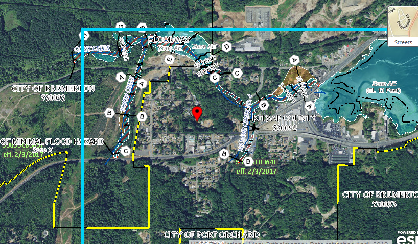
The red dot represents where the Gorst Creek Watershed is and as you can see from the Legend on the right, there is potential flood hazards nearby but not close enough. My guess is this area still needs more observations to determine the risks. However according to this 2015
report, the Gorst roadway areas are at extreme risk for flooding and may be impassable. The report further explains that an alternative transit plan needs to be established in the Natural Hazards Mitigation where it could received funding for it.


Samara, I also had trouble finding data for my local creek, Accotink Creek, in Virginia. The closest data I could find was for the Potomac River, into which the Accotink eventually flows. I only found a local news report which showed flooding from last year, where a car was actually stranded on a nearby road, because the creek level was so high. But, it is good that the local authorities realize that an alternate transit plan is needed for the area.
ReplyDelete